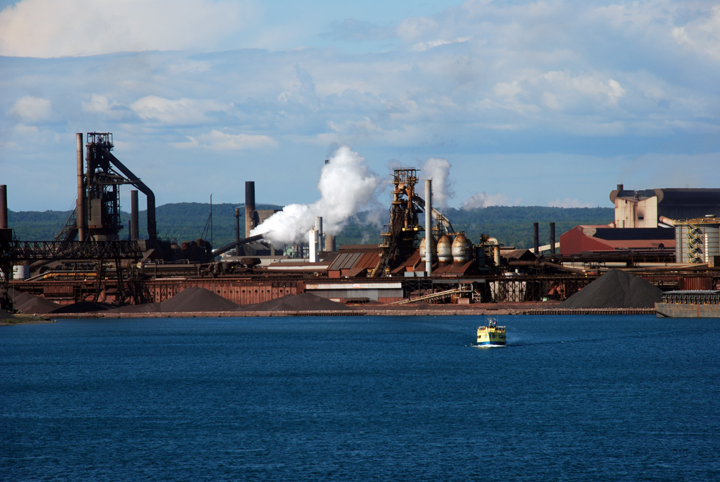
The Soo Locks get most of the attention, but Sault Ste. Marie, Ontario,
is Canada's second largest commercial port on Lake Superior.
Sault Ste. Marie, July 10, 2012, Image 12-1559
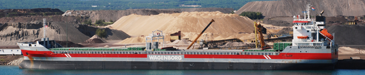
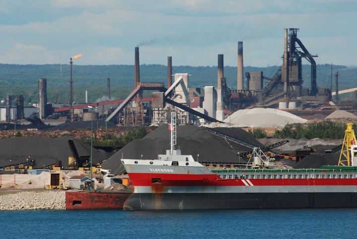
Essar Steel's Algoma mill is a fully integrated steel mill, producing about 2.5 millon tons per year.
Located on a 2,000 acre site at Sault Ste. Marie, Ontario, the mill receives regular shipments of
taconite, coal and limestone from Great Lakes vessels. High quality steel sheets and plates are two of the primary
products produced at the mill. The tour boat
Nokomis gives a good idea
of the size of the mill.
Sault Ste. Marie, July 10, 2012, Image 12-1598
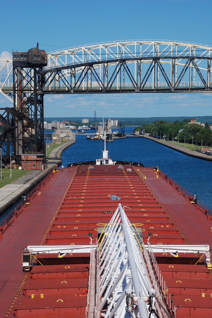
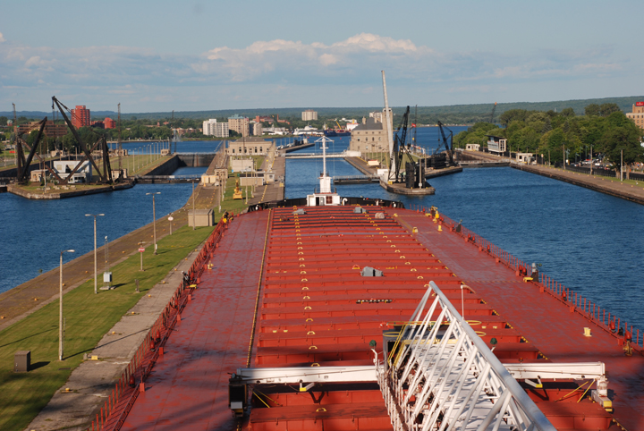
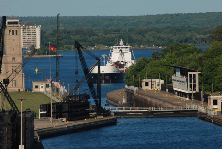
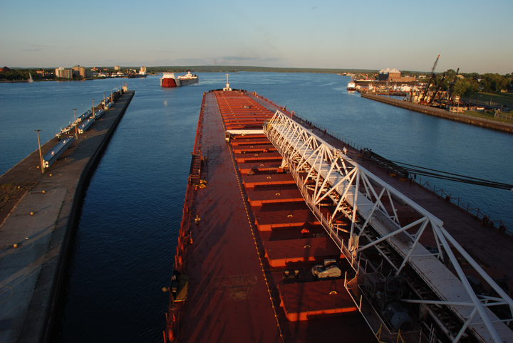
Approaching the American Soo downbound from Lake Superior or the upper St. Marys River
shows the Poe Lock to the left and the MacArthur Lock to the right.
Sault Ste. Marie, July 10, 2012, Image 12-1610
A small repair to a gate at the Poe Lock means the vessel will take a short delay before being allowed
to lock down from Lake Superior. All downbound vessels transiting the Poe Lock are secured by mooring lines
to the long concrete approach wall before entering the lock.
Sault Ste. Marie, July 10, 2012, Image 12-1626
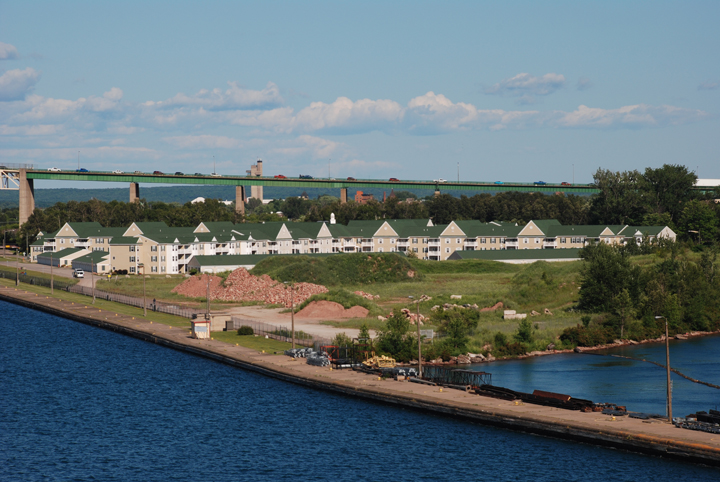
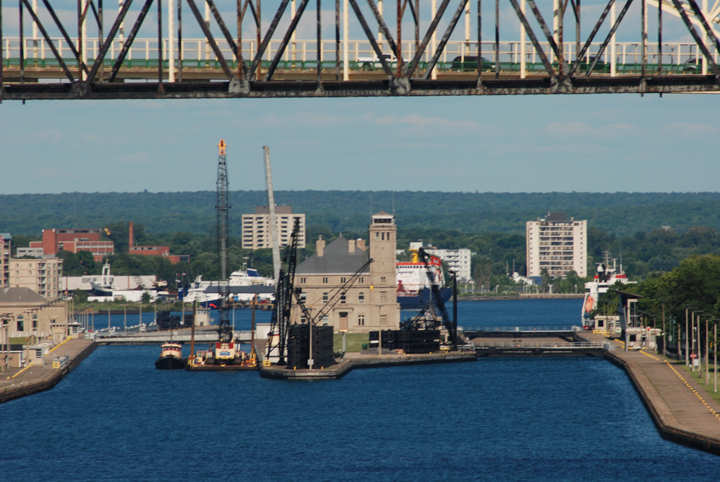
The West Pier at the Soo separates the entrance to the locks from the power canal that feeds the Sault Edison
hydropower plant. Captains and pilots heading down the St. Marys River via the MacArthur Lock use
this approach wall to secure their vessels before entering the lock.
Sault Ste. Marie, July 10, 2012, Image 12-1666
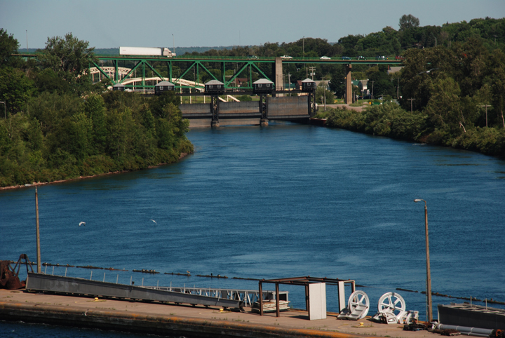
Diverting water from the St. Marys River, the power canal feeds reaches the twenty-six turbines at the Sault Edison
hydro plant three miles downstream of the locks. The canal flows beneath five bridges in the town of
Sault Ste. Marie, Michigan.
Sault Ste. Marie, July 10, 2012, Image 12-1603
From the perspective of the pilothouse, the vessels appears too large to fit through the lock.
In reality, it does, but just barely. The 105-foot beam of the
Indiana Harbor has little room to spare.
The Poe Lock is only 110-feet wide, making it a tight fit for large vessels using the locks.
Sault Ste. Marie, July 10, 2012, Image 12-1626
While the
Indiana Harbor waits to lock down, an upbound vessel approaches
the MacArthur Lock.
The MacArthur Lock was built during World War II and is 800 feet in length and 80 feet wide.
Sault Ste. Marie, July 10, 2012, Image 12-1705
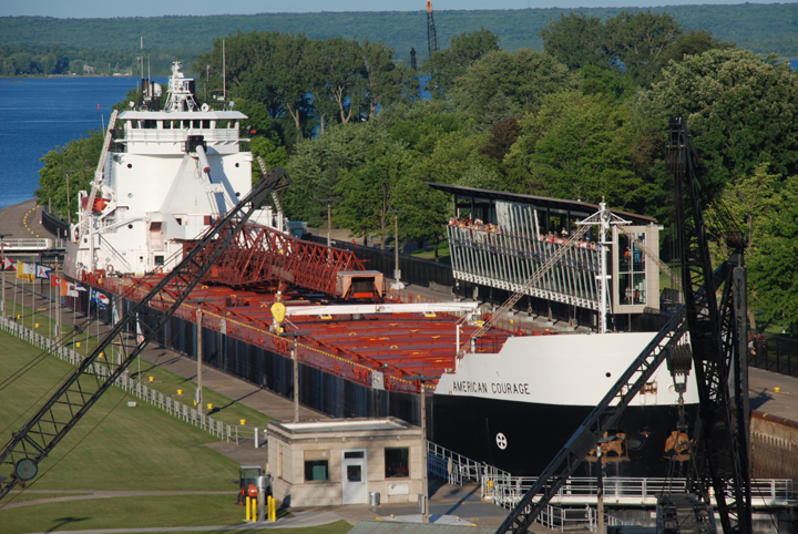
Inside the MacArthur Lock, the
American Courage is raised to the water level of Lake Superior.
The
American Courage is 636-feet long with a beam of 68 feet and was built in 1979. For most of its career
the vessel sailed as the
Fred R. White, Jr. for the Columbia Transportation division of the
Oglebay Norton Company. On this trip the vessel is heading to Silver Bay to load taconite for Cleveland, Ohio.
Sault Ste. Marie, July 10, 2012, Image 12-1771
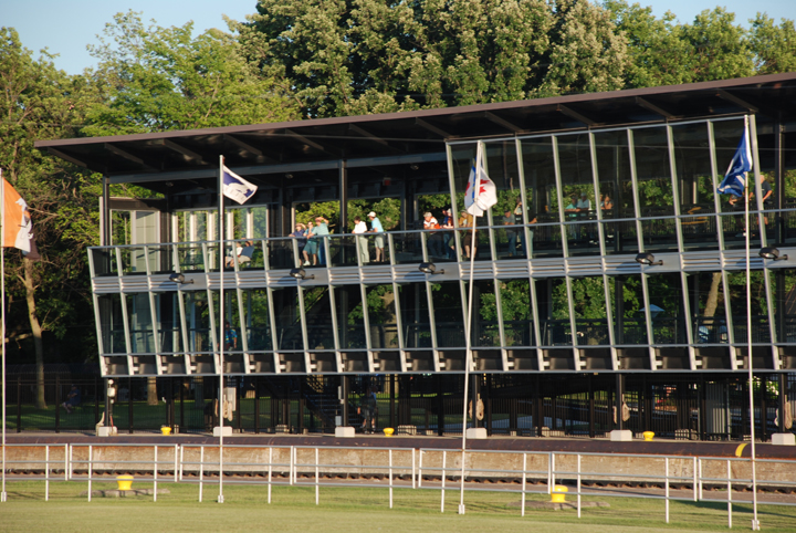
Vistors to the Corps of Engineers park at the Soo can get a close-up view of the locks and vessels from this
viewing platform. There used to be three viewing stations at the Locks but due to heightened concerns over
security they were removed and this single station constructed. The platform looks directly over the MacArthur Lock.
Sault Ste. Marie, July 10, 2012, Image 12-1851
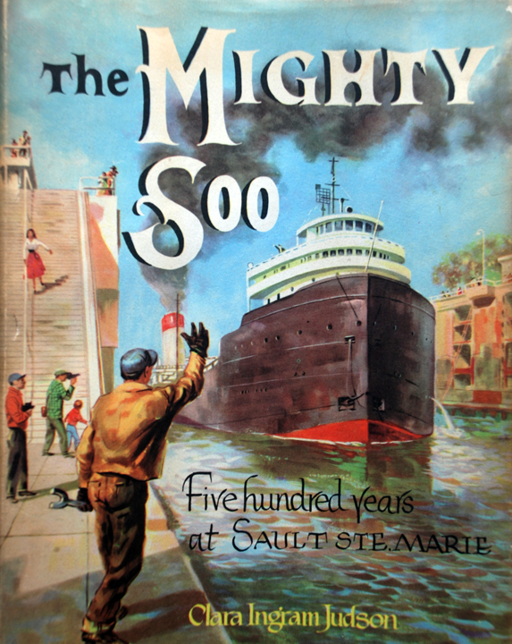
This dust jacket from author the Clara Judson's 1955 book The Mighty Soo shows a nation
at ease with its role as a world leader in the post World War II era. The Soo Locks have been
a sustained tourist attraction in the Upper Midwest for many years.
The Mighty Soo, 1955, Follett Publishing Co.
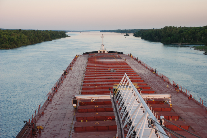
It usually takes a vessel about an hour total to transit the Soo Locks. Once clear of the Poe Lock the
Indiana Harbor enters the lower St. Marys River. From here it takes five
hours to reach the village of
DeTour and the entrance to Lake Huron.
Sault Ste. Marie, July 10, 2012, Image 12-1869
The lower St. Marys, the first of "the rivers" is a series of channels and small lakes dredged to meet
the needs of commercial vessel traffic. The
Indiana Harbor will thread
its way through the Lake George Channel,
Hay Lake Channel, West Neebish Channel (known as Rock Cut), and Mud Lake to DeTour Passage
at the mouth of the St. Marys River.
Sault Ste. Marie, July 10, 2012, Image 12-1908